Google Maps Pac-Man is on its deathbed. Long live Google Maps Pac-Man.
Any day now, Google will take down it's awesome experiment, which launches Pac-Man on top of real-life city streets within Google Maps. It launched this wonderful time-suck last week as an April Fools' Day prank, so it was never meant to stick around long. But this is the Internet, where anything can happen, and damned if the game's mix of whimsy and nostalgia didn't make it resonate in a way few other Google pranks ever did.
Still, all things must pass, as the man once said, and that cheerful Pac-Man icon in the lower left corner of Google Maps is sure to go. And when it does, there will be no joy in Mudville---or any other playable location, for that matter.
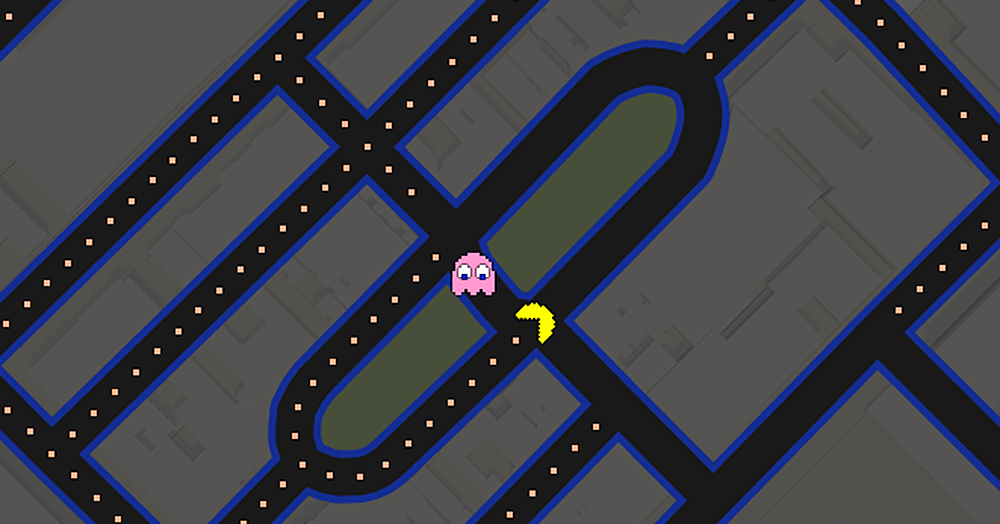
Even though "Pac-Maps" was a huge hit that inspired lists of "must-play" locations (you've gotta play Harvard Square), its lifespan was always meant to be short. It was created by John Tantalo, a software engineer at Google, and his wife Mary Radcliffe, an assistant professor of mathematics in the field of graph theory at University of Washington. They'd worked together on games before, creating Planarity back in the mid-aughts.
Radcliffe was a big fan of Ms. Pac-Man in college, and Tantalo first thought about mashing up Pac-Man and Google Maps during an engineering internship at the company in 2006. There was just one problem: it wasn't technically possible.
That changed in 2010. As this Official Google Blog post explains, Google Maps started using vector graphics to draw its maps instead of a patchwork of 256x256-pixel images. That made Maps load more smoothly, made it more responsive to resizing, and made offline caching more efficient, among other things. And because the vector tiles include more-parsable data, it also helped make Google Maps Pac-Man a reality.
"The vector tiles allow us to use just the road network to create the maze," Tantalo says. "(And) place pac-dots, power pellets and bonuses, and enable Pac-Man and ghosts to traverse it."